Heatwave Peaks Early in the Week with Yellow Alerts Issued for Multiple Regions
According to a joint forecast by Spain’s national meteorological agency (Aemet) and the meteorological platform Meteored, Spain has started June with temperatures well above the average for this time of year. This Monday, the heatwave will continue in full force, marking one of the hottest periods of this event.
In response, Aemet has issued yellow high-temperature warnings for several regions, including the southern Community of Madrid, the province of Albacete, and the Andalusian provinces of Jaén, Córdoba, and Seville. Maximum temperatures are expected to reach 38 to 40°C in parts of Andalusia, while areas like Madrid and Albacete will see temperatures exceed 36°C. Most inland areas in the southern Iberian Peninsula and the northeastern lowlands are also affected by the high heat. Furthermore, central and southern Spain, along with the Mediterranean coast, will continue to experience “tropical nights,” where minimum temperatures remain above 20°C, affecting nighttime rest.
Cold Air Arrives, Temperatures to Gradually Decrease from Tuesday
Starting this Tuesday, as a mass of cooler air gradually moves in, temperatures across Spain will begin to fall, with conditions expected to return to near-seasonal norms. Maximum temperatures in the Guadalquivir Valley and southeastern regions are forecast to drop to around 35 to 36°C, while Madrid’s high will fall back to 33°C.
The temperature difference between the north and south will become particularly noticeable. In northern Spain, maximum temperatures in Galicia and parts of the Cantabrian coast may not even exceed 25°C, with many northern cities experiencing daytime temperatures below 23°C, feeling considerably cooler.
Increased Atmospheric Instability to Bring Thunderstorms Later in the Week
As temperatures drop, atmospheric instability will gradually increase in parts of Spain during the latter half of the week. On Tuesday, a frontal system will first affect the north, bringing light rain to Galicia and the Cantabrian coast. In the afternoon, the risk of strong convective rainfall and thunderstorms will significantly increase in the eastern Pyrenees and northern Catalonia (especially the Girona area).
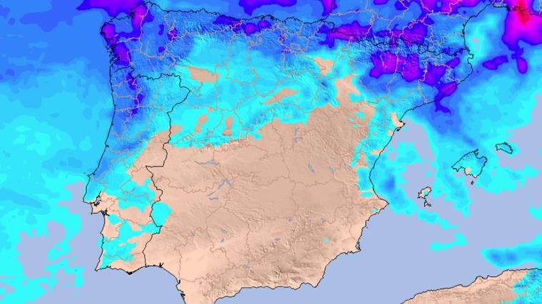
Wednesday’s weather will be generally stable, although scattered showers may still occur in Galicia and Cantabria. By Thursday, the approach of an upper-level trough will further increase atmospheric instability, leading to rainfall in Galicia and along the Cantabrian coast, while thunderstorms are possible in the Pyrenees, northern Catalonia, the northern Valencian Community, and Aragon.
Weekend Outlook: Rain Possible Amidst Uncertainty
Unstable weather patterns are expected to persist into Friday, with light rain in the northern Iberian Peninsula and the potential for more showers and thunderstorms along the Mediterranean coast. For the upcoming weekend, although meteorological models still show some uncertainty, initial forecasts suggest a continued possibility of rain and thunderstorms in Aragon, inland Catalonia, the Valencian Community, the Region of Murcia, and eastern Castile-La Mancha.