After enduring multiple heatwaves and severe forest fires in July, Spain’s upcoming weather pattern for August is drawing significant attention. According to an analysis of the latest models from the European Centre for Medium-Range Weather Forecasts (ECMWF) by experts at the meteorological agency Meteored, the climate in August could see a crucial turning point in the second half of the month after continued intense heat in the first half.
Early August: The Heat Lingers
Forecasts indicate that for the first two weeks of August, the suffocating heat of July will continue to blanket most of Spain. Temperatures along the Mediterranean coast and in the Pyrenees are expected to be 3 to 6 degrees Celsius above the normal for this period, while most other parts of Spain will also see temperatures 1 to 3 degrees higher than average. Only the western regions of the peninsula might maintain temperatures within the normal range. This continuation of the heatwave presents a renewed challenge for areas already strained by high temperatures.
Mid-Month Turning Point: First Signs of Storms
The first signs of a weather change are expected to appear in the second week of August (around August 10-17). During this period, the probability of convective storms (i.e., thunderstorms) forming will increase, likely accompanied by more cloud cover. Notably, this week coincides with astronomical events such as the Perseid meteor shower and a total solar eclipse, and the presence of clouds and storms could impact viewing activities.
Late August Outlook: “Thunderstorm Nests” and Rainfall Anomalies
Moving into late August, the shift in the weather pattern will become more pronounced. Forecasts suggest that the Mediterranean coastal areas may experience what meteorologists call “thunderstorm nests” (nidos de tormentas), indicating intense storm activity. At that time, eastern Spain, the Balearic Islands, inland mountainous areas, and the Cantabrian region could see positive rainfall anomalies, meaning precipitation levels above the historical average. This increase in instability is linked to higher sea surface temperatures at the end of summer, which provide energy for storm formation.
Meteorological Cause: Atlantic Blocking Steers Cold Air South
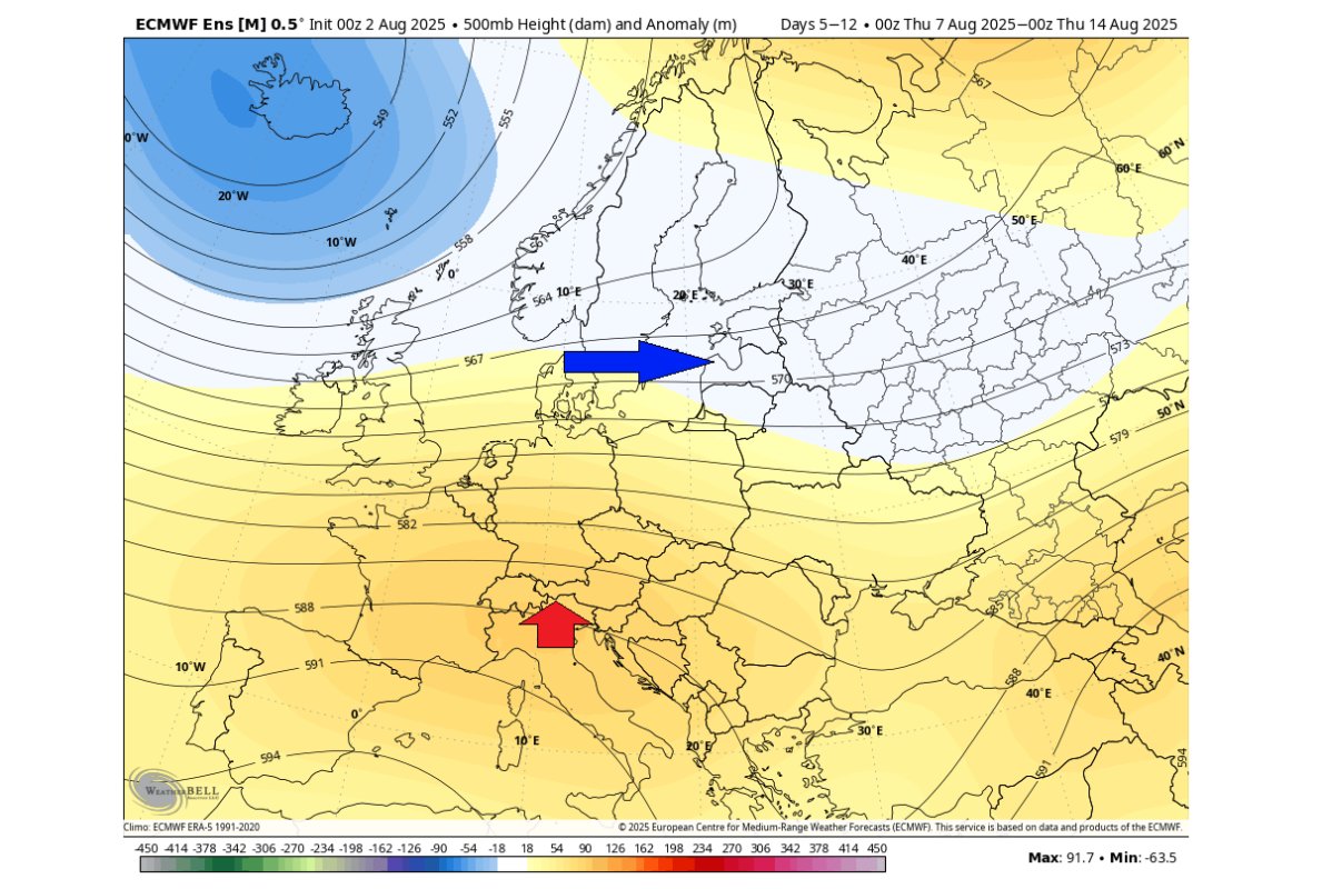
The driving force behind this potential dramatic climate shift is believed to be related to the formation of an ‘Atlantic blocking’ or ‘high-pressure ridge’ pattern. This atmospheric circulation pattern would cause the path of the Polar Jet Stream to become more meandering, potentially opening a channel for cold air from higher latitudes to pour south towards the Iberian Peninsula. This would be the key factor in breaking the persistent high-temperature stalemate and bringing cooler temperatures and rain. However, meteorologists also stress that long-range precipitation forecasting in summer is highly complex, as convective rainfall is often localized and unevenly distributed. The specific scope and intensity will require closer observation as the time approaches.
