Temperatures Plunge on Friday, Falling Below Seasonal Averages
Following the intense heat earlier this week, Spain began to experience a significant temperature drop on Friday. According to data from the forecasting agency Meteored, temperatures are continuing to fall across most of the country, especially in the north and northeast, with many areas already seeing readings below the normal average for August.
Specifically, northern coastal regions such as Galicia, Asturias, Cantabria, the Basque Country, and Navarre will see maximum temperatures fall to between 21 and 25 degrees Celsius. Inland northern areas will experience temperatures ranging from 23 to 30 degrees Celsius. In contrast, the southwest will see a slight rebound to 30-33 degrees Celsius, while southeastern regions like Murcia could still reach highs of 35 degrees Celsius.
Weekend Front to Bring Heavy Rain and Thunderstorms to the North
Meteorologist José Antonio Maldonado has warned that a frontal system associated with the cold air mass will deepen in the North Atlantic this Saturday and directly affect the Iberian Peninsula. This front is expected to bring substantial rainfall to the northern and northeastern parts of the peninsula, with heavy downpours and potential thunderstorms in some areas.
As the front passes, cloud cover will increase in other parts of the peninsula. By Sunday, the main body of the cold air mass is expected to remain over the western part of the peninsula, continuing to influence the weather. Increased cloudiness is anticipated in the north and the Balearic Islands, with a continued risk of strong, localized thunderstorms in the northeast. Precipitation in the south will be more scattered and weaker.
Rare August Cyclone May Form, Leading to Highly Unstable Weather Next Week
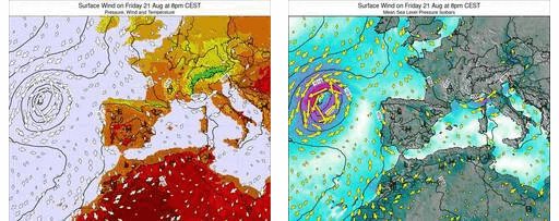
Maldonado noted that a noteworthy phenomenon in this weather event is the potential formation of a ‘considerably deep’ cyclone over the waters west of the peninsula this weekend. He emphasized that if this forecast materializes, the weather in Spain early next week will become ‘extremely unstable’.
Cyclone activity of this intensity is quite rare for Spain at the end of August. It could lead to localized, strong thunderstorms and persistent rain in the northern regions. However, the meteorologist added that the cyclone’s final path and intensity remain uncertain, and its future trajectory will be the key factor determining next week’s weather. Meanwhile, parts of the Mediterranean coast may remain unaffected, continuing to experience high temperatures in stark contrast to the cooler weather along the Atlantic coast.
